
Geomorphological Survey of the Salt Marsh and the Sandspit of Portneuf-sur-Mer (2018)
As part of a characterization carried out by the Comité ZIP de la Rive nord de l'estuaire and in collaboration with Maxime Boivin (geomorphologist), Gabriel Joyal (geomorphologist) and Antoine Morissette (geomorphologist), a geomorphological survey was carried out on the marsh and sandspit of Portneuf-sur-Mer. This database includes the methodology and results of the survey as of October 27, 2018.
You can access the biophysical characterization of the Portneuf-sur-Mer marsh by consulting the dataset: The Portneuf-sur-Mer salt marsh - Characterization of important coastal habitats on the north shore of the St. Lawrence Estuary
Data and resources
-
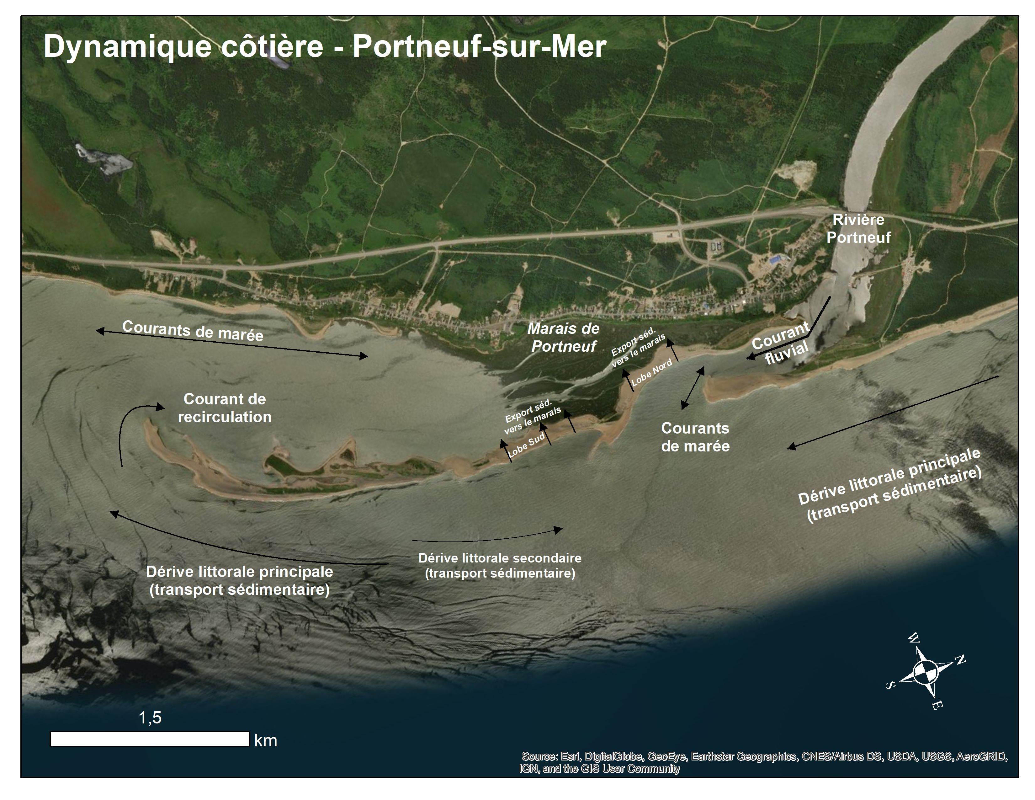
Map of coastal dynamics in the Portneuf-sur-Mer areaPNG Open
-
Description of the different layers present in the datasetPDF Open
-
7 shapefiles containing various geomorphological informationsZIP Open
-
Orthophotography with 7cm resolution of the Portneuf-sur-Mer areaZIP Open
-
Orthophotography with a resolution of 3cm of the Portneuf-sur-Mer areaZIP Open
-
Elevation-based classes of MFFP LiDAR dataZIP Open
-
Digital Elevation Model (DEM)ZIP Open
Additional information
| Temporal extent | 2018-10-27 – 2018-10-28 |
|---|---|
| Vertical extent | 0.0 – 0.0 m |
| Date (creation) | 2018-10-27 |
| Date (publication) | 2020-03-25 |
| Date (revision) | 2020-03-25 |
| Status | completed |
| Update frequency | asNeeded |
| Metadata language | fr |
| License | Creative Commons Attribution 4.0 |
| Source metadata | ISO 19115 XML |
| Last updated | 2026-07-31 |
| Created | 2026-07-31 |
| API | package_show |